

A waterspout that walked ashore in the last days of summer became, in the span of thirty minutes, the first confirmed tornado to touch down in Nassau County in roughly five years — and a case study in how coastal tornadoes form, get identified, and get missed until the wreckage forces the question.
Key Points
- The National Weather Service confirmed a tornado came onshore in Atlantic Beach, New York, between 6:30 and 7:00 p.m. on August 20, based on radar data, video of the waterspout crossing the shoreline, and ground damage patterns.
- The storm tore through the Sun and Surf Beach Club, destroying or damaging roughly 30 to 50 cabanas while more than 100 guests were on the property.
- One minor injury was reported; no serious injuries occurred despite the scale of the structural damage.
- Nassau County Executive Bruce Blakeman declared a state of emergency as more than 15 fire departments responded to the beach club.
- The event underscores how waterspouts and tornadoes are the same rotating vortex under different names — and why official confirmation always trails the video by hours.
What Happened at Atlantic Beach
Severe thunderstorms moved across the New York metropolitan area on the evening of August 20, spawning at least one confirmed tornado and a second waterspout under investigation near the Rockaways in Queens. The National Weather Service’s forecast office in Upton, New York, later issued a formal Public Information Statement describing what it saw: a waterspout that “likely paralleled the far southeastern portion of the Rockaway near the mouth of the East Rockaway Inlet and came onshore as a tornado in the far west end of Atlantic Beach” during the half-hour window ending at 7:00 p.m. That single sentence is the backbone of the official record — radar signature, visual confirmation, and a damage footprint that lined up with all three.
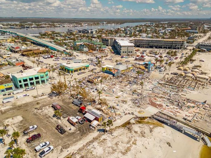
The most visible casualty was the Sun and Surf Beach Club, a longtime fixture of the Atlantic Beach shoreline. Fire officials reported that the club had more than 100 guests on site when the wind hit just before 7 p.m., ripping roofs off cabanas, pulling down walls, and scattering debris across the property. Estimates of the damaged or destroyed cabana count ranged from roughly 30 to 50 depending on the source and the point in the assessment timeline — a normal spread when officials are still walking the site room by room. One employee sustained a minor injury and declined further medical treatment; no one else was hurt, a remarkable outcome given how quickly the structures came apart. The club closed indefinitely, though fire officials noted the core building’s structural integrity remained intact.
How a Waterspout Becomes a Tornado
The distinction between a waterspout and a tornado is not physics — it is geography. Meteorologists classify a rotating column of air over open water as a waterspout; the instant that same vortex crosses onto land, it is reclassified, by NWS convention, as a tornado, provided it retains a connection to the parent thunderstorm’s rotating updraft. Forecasters at coastal offices like the one covering Long Island rely on a specific playbook developed over decades of research into these systems: they study atmospheric soundings for the warm, moist, weakly-sheared conditions that favor spout formation, then watch radar for the low-level boundaries — sea breeze fronts, outflow boundaries — where spin can concentrate. Boundary detection is, in the National Weather Service’s own technical language, “paramount” once favorable conditions are in place.
What differentiates this class of tornado from the more famous Great Plains variety is scale and warning lead time. Waterspout-origin tornadoes typically register as EF0 or EF1 on the Enhanced Fujita scale — winds under 110 miles per hour — but they can still shred lightly built structures like beach cabanas, pergolas, and pool enclosures with ease, precisely because those structures are designed for wind load, not rotational shear. They also form and dissipate fast, often in under an hour, which is why confirmation nearly always happens after the fact: a survey team walks the damage path the next morning, cross-references it against radar returns and citizen video, and only then issues the kind of formal statement the National Weather Service released for Atlantic Beach.
Why This Was Unusual for Long Island
Long Island sees tornadoes far less often than the interior United States, and Nassau County specifically had gone roughly five years without a confirmed touchdown before this one. That rarity is a function of geography, not immunity: the same maritime moisture and coastal boundaries that generate waterspouts off the Rockaways and the barrier islands can, under the right synoptic setup, produce landfalling tornadoes, but the ingredients align infrequently enough that most Long Islanders have never seen one up close. County Executive Bruce Blakeman’s swift declaration of a state of emergency reflected that unfamiliarity as much as the damage itself — a recognition that the region’s infrastructure and public expectations are built around nor’easters and hurricane remnants, not funnel clouds.
The Response and the Recovery
More than 15 fire departments mobilized to the Sun and Surf Beach Club within minutes, a response scaled to the possibility — later ruled out — that guests or staff were trapped beneath collapsed cabana roofs. That mutual-aid surge, drawing departments from across Nassau County to a single beachfront property, is itself a data point worth remembering: coastal tornadoes strike in the same season, and often the same hours, when beach clubs and marinas are at peak occupancy, which is exactly when a fast-moving, short-lived storm offers the least warning to the most people. The club’s leadership confirmed the closure would last until further notice while contractors assessed cabana-by-cabana damage, even as the main clubhouse structure was found sound.
What It Means Going Forward
Coastal tornado events like this one are not freak anomalies so much as a known, if underappreciated, seasonal risk along the mid-Atlantic and Northeast shorelines. The National Weather Service’s confirmation process — radar plus video plus ground survey — exists precisely because these storms move too fast for warning systems tuned to slower-developing severe weather, and because the visual of a waterspout crossing a beach can look identical whether it causes minor spray damage or, as in Atlantic Beach, levels dozens of structures. For property owners, insurers, and municipal planners along the Long Island shoreline, the practical lesson is straightforward: cabanas, pergolas, and other lightweight beachfront structures sit in the same wind-risk category as their inland counterparts during severe thunderstorm season, regardless of how rare a “tornado” label feels in a region better known for nor’easters.
A waterspout turned into a tornado in Atlantic Beach, New York on Thursday, August 20, 206, causing damage off the Long Island coast.
An eyewitness video showed a spout forming near the shoreline, before dissolving shortly after landfall, local media reported.
The powerful… pic.twitter.com/RumtBux57R
— GMA News (@gmanews) August 21, 2026
Sources:
abc7ny.com, longisland.news12.com, thedailybeast.com, yahoo.com, newsday.com, patch.com, weather.gov, fox5ny.com, gothamist.com