

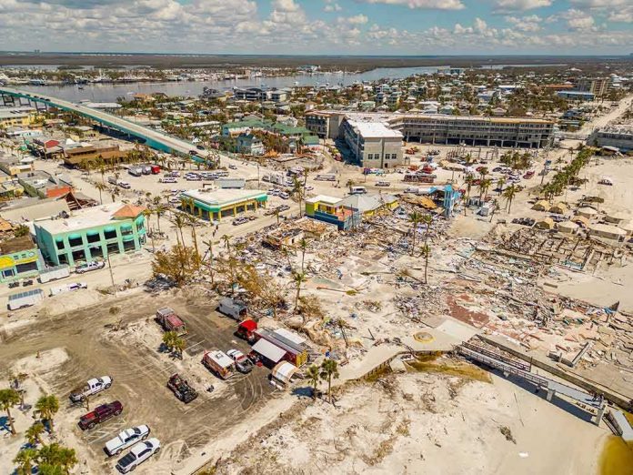
In seismology, the number that travels fastest is magnitude; the human toll takes longer to surface. A powerful M7.7 earthquake struck off Indonesia’s Flores Island, with lethal shaking onshore and a short-lived tsunami alert—an event that fits the region’s tectonic script and its response systems just as precisely as it defied any illusion of safety.
At a Glance
- A magnitude 7.7 earthquake ruptured at shallow depth north-northwest of Ende, Flores Island, causing deadly shaking and structural collapse.
- Indonesia’s BMKG issued a tsunami warning in the early phase; coastal communities moved to higher ground before alerts were lifted.
- Authorities and multiple outlets reported at least 20 fatalities as rescue operations navigated landslides, aftershocks, and damaged roads.
- The quake’s location and mechanism align with the Flores back-arc thrust system—a known generator of severe shaking and, at times, tsunamis.
What happened: a major offshore rupture and a rapid warning cascade
The United States Geological Survey logged the event as magnitude 7.7 at approximately 10 km depth, centered roughly 68 km north-northwest of Ende on Flores Island. Shallow earthquakes of this size can deliver intense ground motion across island arcs; this one did, toppling buildings and driving residents into the streets at dawn. USGS impact modeling indicated exposure to strong to severe shaking for well over a million people, a pattern consistent with the building damage and casualty reports that followed.
Indonesia’s Meteorology, Climatology, and Geophysics Agency (BMKG) triggered its tsunami early warning workflow within minutes, flagging the potential for dangerous coastal effects along parts of East Nusa Tenggara and neighboring regions. Broadcasts and mobile alerts moved people uphill while tide gauges were scrutinized—standard doctrine for a shallow, offshore thrust rupture. As observational data came in, authorities narrowed and then lifted warnings, but not before the evacuation step had already reduced risk along vulnerable shorelines.
Casualties and damage: why the count climbs after the shaking stops
Initial media tallies varied as they always do in Indonesia’s dispersed archipelagic geography. Within hours, national and international outlets converged on reports of at least 20 deaths, alongside injuries and widespread structural damage in East Nusa Tenggara. Rescue agencies described landslides, road blockages, and a drumbeat of aftershocks that complicated search and retrieval. The Strait Times, CNBC, and Al Jazeera contemporaneously described the rising toll and on-the-ground conditions as responders moved through rubble and unstable slopes.
This lag between magnitude certainty and casualty clarity is not aberrant—it is structural. BMKG’s remit in the first hour is hazard characterization and tsunami risk messaging; formal injury and fatality verification relies on provincial disaster agencies, health systems, and police reporting that travel more slowly than seismic waves. In eastern Indonesia, where road networks are thin and relief assets must hopscotch islands, that delay lengthens further. The result is the familiar two-step: fast, conservative alerts first; sober casualty confirmation later.
Tectonic setting: the Flores back-arc thrust and why it matters
Flores sits on a geodynamic hinge where the Australian Plate subducts beneath the Sunda-Banda arc. While the iconic megathrust lies to the south, the northern margin of Flores is defined by a back-arc compressional system—the Flores back-arc thrust—capable of large reverse-fault earthquakes with high intensity shaking on nearby islands. Indonesian officials linked this event to that system and reiterated its upper-end potential in the high-7s, squarely in line with regional seismotectonics and historical precedent.
Back-arc thrust events differ from deep slab earthquakes that sometimes rattle Indonesia without heavy damage. At roughly 10 km depth, a reverse rupture couples energy efficiently into the crust directly beneath communities; peak ground accelerations can overwhelm unreinforced masonry and older concrete frames. That is why buildings crumble inland even when the epicenter lies offshore, and why mortality correlates more with construction type and local site conditions than with the oceanic location of the fault plane.
Tsunami risk in context: fast alerts, measured water
A shallow, offshore reverse event justifies immediate tsunami alerts in Indonesia; the cost of a false alarm is a hurried hill climb, the cost of a delayed one is mass casualty. BMKG’s InaTEWS network automates that posture: real-time seismology informs a first-cut alert, while sea-level instruments—tide gauges and deep-ocean sensors where available—refine the picture. In this case, authorities warned of possible significant waves in select zones, then withdrew broad alerts as observations constrained the hazard envelope.
This is how a mature tsunami system behaves after painful lessons—acting on physics before confirmation, then throttling back with data. The 2004 Aceh disaster and later Sulawesi events taught Indonesia and its neighbors that a minutes-matter bias saves lives, even when later measurements show modest or localized runup. Modern guidance also reflects the reality that destructive tsunami effects can be intensely local, driven by submarine landslides or coastal geometry, and may not register as basin-wide threats.
Why the numbers diverge early—and converge later
Readers often encounter a swirl of casualty figures in the first news cycle. Here, early wire updates mentioned two confirmed deaths before agencies on the ground raised counts to at least 20 as daylight operations widened. That pattern is neither media sloppiness nor official opacity; it is the arithmetic of access. Outer-island clinics report hours late. Collapsed structures reveal their burdens after heavy equipment arrives. Some injuries become fatalities in overwhelmed hospitals. By the second or third day, the variance narrows as redundant reports are reconciled and missing persons lists firm up. The Indonesian record—from Flores in 1992 to more recent arc events—shows that this is the rule, not the exception.
USGS products can add to the impression of precision—moment magnitude to the tenth, hypocentral depth in kilometers—while their impact estimates remain probabilistic, expressed as ranges of potential casualties and economic loss. Those ranges are not hedging; they are calibrated to the ground-truth cadence of post-quake discovery and should be read as decision support for responders, not tally sheets for the public.
Built environment and consequence: what failed, and why it keeps failing
The severity of shaking reported across Flores and nearby islands is consistent with building damage in towns where unreinforced masonry and non-ductile concrete frames dominate the older stock. In many Indonesian communities, incremental improvements—confined masonry, ring beams, better rebar practice—compete with legacy construction and informal additions that introduce soft stories and brittle failure points. In a thrust event, vertical and horizontal components of motion can combine to punish such vulnerabilities. Retrofitting at scale is slow; enforcing up-to-date codes on new construction is faster, cheaper, and more politically tractable—but only if credit markets, local permitting, and public demand align.
This is not an abstract policy debate. Every percentage point of masonry confined, every column with proper stirrups, translates into fewer pancake collapses when a shallow M7+ rupture unloads beneath a district capital. In archipelagic regions with evacuation constraints and limited heavy rescue capacity, prevention in the building stock is the only lever that consistently reduces mortality.
Aftershocks and operational risk
Aftershocks in the M5–M6 range typically follow an event of this size; they prolong fear and complicate rescue logistics by destabilizing damaged structures and triggering additional slope failures. The operational playbook—cordon unsafe buildings, meter access, prioritize shoring—presumes that the largest aftershock often lands within the first day but that elevated seismicity persists for weeks. Crews on Flores faced exactly that profile, managing landslide risks on narrow mountain roads while moving equipment and medical supplies into affected towns reported by national and international outlets.
How this compares: the long memory of Flores
Flores carries a painful seismic ledger. The 1992 Flores earthquake and tsunami, comparable in magnitude to this event, killed thousands—a catastrophe amplified by a direct tsunami impact and highly vulnerable coastal settlements. Later events, including 1982 and 2021 quakes, produced lower but still significant casualties and structural damage, reinforcing the island’s exposure profile and the premium on resilient construction and rapid coastal evacuation when alerts sound.
This latest M7.7 belongs to that lineage: a back-arc thrust rupture with intense local shaking, a precautionary tsunami warning, and a casualty count that climbed as access improved. The difference between catastrophe and crisis is often a handful of parameters outside human control—rupture directivity, slip distribution, submarine slope stability—and two that are not: building practice and public readiness to move uphill in minutes, not hours.
What it means going forward
For residents of Flores and the surrounding islands, recovery will track the familiar arc: emergency shelter, debris clearance, rapid damage assessment, then a long tail of repairs to homes, schools, clinics, and ports. For Indonesia’s risk managers, the event validates the core of their warning architecture while sharpening perennial challenges—last-mile alerting to fisherfolk and tourists, maintenance of tide gauges, and ensuring that safe high ground remains accessible when roads fail. For the broader public, the lesson is stark and transferable across seismic arcs: magnitude is a proxy for energy release, not a verdict on outcome. Outcomes are determined by distance, depth, directionality—and what we have built, where we have built it, and whether we move when told.
Sources:
en.wikipedia.org, earthquake.usgs.gov, aljazeera.com, straitstimes.com, inatews.bmkg.go.id, en.antaranews.com