

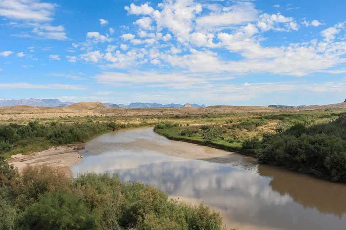
When a river draws an international boundary, land is never just land; it is law, history, and operational leverage. Texas’s move to formally identify nine Rio Grande islands as state property sits at the intersection of all three—an assertion grounded in archival surveying work and framed as a security enabler, yet constrained by the treaty machinery that ultimately decides where the line actually runs.
At a Glance
- Texas’s General Land Office (GLO) identified nine Rio Grande islands—about 66 acres total—as state-owned to enable patrol, clearing, and access by Texas security agencies.
- The determination was based on historical records, surveys, and related materials, not a bare political decree; prior GLO work established the model on earlier islands.
- Mexico has pushed back publicly; the U.S.–Mexico treaty system assigns islands by their relation to the river’s deepest channel and how landforms arose.
- The security rationale is clear in concept—deny cover and “safe haven” to smugglers—but incident-level evidence for each island has not been released.
What Texas actually did—and why it matters for operations
The GLO announced it had identified nine islands between Laredo and McAllen as state-owned, totaling roughly 66 acres. The Land Commissioner explicitly linked that conclusion to access: the Department of Public Safety (DPS) and the Texas Military Department (TMD) would be able to patrol, inspect, and clear the islands of illegal activity consistent with law. This was not presented as a rhetorical flourish but as an operational directive aimed at removing hesitation about who can go where and do what. The agency said it reached the decision after reviewing historical records, surveys, and other information; local reporting echoed that methodology rather than treating the move as a mere press-conference claim.
Functionally, state title can simplify logistics and liability. If an island is state land, DPS or TMD can plan sustained presence, vegetation clearing, and infrastructure placement with fewer permissions and less legal ambiguity. The GLO has done this before: in 2025 it identified islands near Roma for TMD at a moment when security planners described the thicketed terrain as a “smuggler’s paradise” whose cover could be reduced through clearing operations. That earlier cycle established a playbook—determine status, notify partners, then operationalize access—that the 2026 announcement extends across a wider stretch of the river.
The boundary is a legal machine, not a hunch—how islands are actually assigned
None of this occurs in a vacuum. The U.S.–Mexico boundary in the Rio Grande’s limitrophe reach is governed by treaties that define the international line by the center of the deepest channel (the thalweg) and distinguish between gradual river changes (accretion) and sudden channel shifts (avulsion). That framework has been administered for more than a century by the International Boundary and Water Commission (IBWC) and its earlier incarnations, which have adjudicated countless bancos—cutoff meanders and islands—by applying technical surveying and treaty rules.
The practical upshot is straightforward: where an island sits relative to the thalweg matters, but so does how it formed. If sediment built up gradually on the U.S. side of the thalweg, the boundary can migrate with it; if a flood carved a new channel overnight, the legal line may remain in the old bed. Historic disputes, such as over Morteritos Island, turned on precisely these points, with Mexico at times producing surveys to show the deepest channel placed a contested landform on its side of the boundary. These are not abstractions; they are the rules that determine whether a patrol’s presence is routine administration or a diplomatic incident.
What is settled, what is not: weighing the evidence on the nine islands
On the evidence available, two claims are well-supported. First, Texas did conduct an internal review—historical records and surveys—and emerged with a conclusion that nine specified islands belong to the state, totaling roughly 66 acres. Second, the GLO intended that determination to remove operational hesitation for DPS and TMD by affirming access for patrol, inspection, and clearing consistent with law. As a matter of state-level property administration, those are concrete, documentable actions.
What remains open is the international and intergovernmental acceptance of each island’s status. Reporting indicates Mexican officials pushed back against Texas’s claim. The Land Commissioner also acknowledged that other islands the state examined likely fell on Mexico’s side based on location in the river—an implicit nod to the thalweg logic that governs assignments. The treaty framework is the arbiter here; while a state title determination can clarify Texas’s own posture, it does not by itself settle a cross-border boundary question. That is where IBWC proceedings and, if necessary, formal consultations come in.
The security case: conceptually sound, evidentiary gaps at the island level
The security argument is intuitive. Dense riparian vegetation and mid-channel terrain can provide concealment, staging sites, and stash locations—terrain that benefits small, adaptive groups moving illicit goods or people. Texas explicitly framed the islands as potential “safe havens” for cartel-linked activity and said that clearing cover and enabling routine patrols could reduce that advantage. The state has made similar claims before, and prior deployments in the Rio Grande Valley have emphasized drone threats, riverine shots fired from the Mexican bank, and the need to control small launch-and-hide sites.
What is missing in the public record is island-by-island corroboration—arrest logs, seizures, drone footage, or incident reports tied to each of the nine parcels. That does not undercut the general terrain logic, but it does make outcome claims—what changed after designation—hard to verify. The strongest way to convert this from a plausible theory of the case into an assessed result is to release pre/post metrics: patrol frequency, interdictions, vegetation-management operations, and response times mapped to each island, alongside incident narratives from DPS, TMD, and federal partners.
Commissioner Dawn Buckingham, M.D., recently announced that nine islands along the Rio Grande River have been declared state land. The 66 acres were previously undeclared and are now officially a part of Texas.
Declaring these lands will allow federal and state law enforcement… pic.twitter.com/11lKzsamlr
— Texas General Land Office (@TXGLO) October 29, 2026
How to resolve the hard questions: disclose the record and route through the treaty channel
Two steps would bring clarity without theatrics. First, publish the island files: survey plats, coordinates, acreage calculations, historical channel maps, title records, and the legal memorandum that applies accretion/avulsion doctrine and the thalweg to each parcel. An island-by-island appendix—chain of title, survey control, and boundary reasoning—would allow independent geospatial scrutiny and reduce space for caricature. Second, engage the IBWC process to secure concurrence on boundary placement where needed. That pathway exists for precisely these situations; it converts unilateral determinations into binationally recognized facts on the ground.
Bottom line for readers who care about outcomes, not optics
Texas has done what a land administrator can do within its lane: inventory likely state property, make an evidence-based title call, and notify its security agencies that they can operate accordingly. Mexico’s pushback and the treaty machinery remind us that islands in a boundary river are assigned by legal criteria, not press release—and that finality arrives through IBWC channels, not state pronouncements alone. The security rationale is coherent and consistent with prior operations, but the public file needs specificity to move from argument to assessment. Publish the record, run the treaty process, and measure the results. That is how you turn contested islands into settled ground and strategic talk into demonstrated security gains.
Sources:
youtube.com, borderreport.com, newsnationnow.com, audacy.com, news4sanantonio.com, foxsanantonio.com, glo.texas.gov